
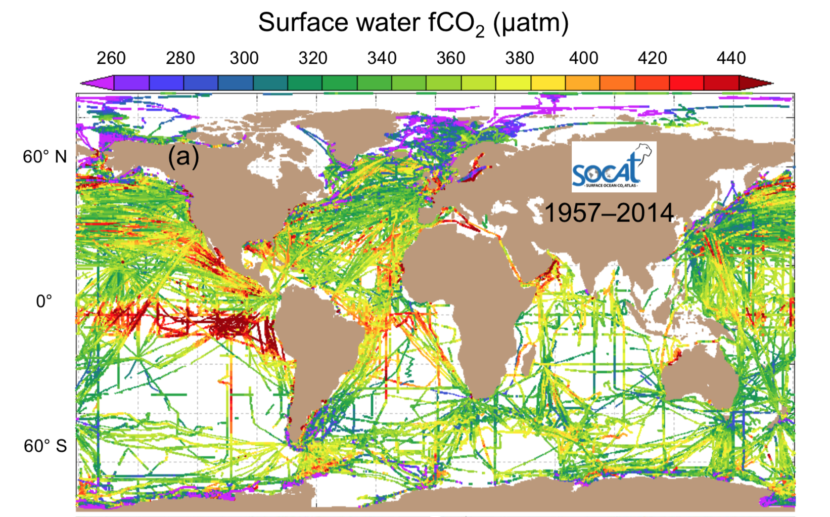
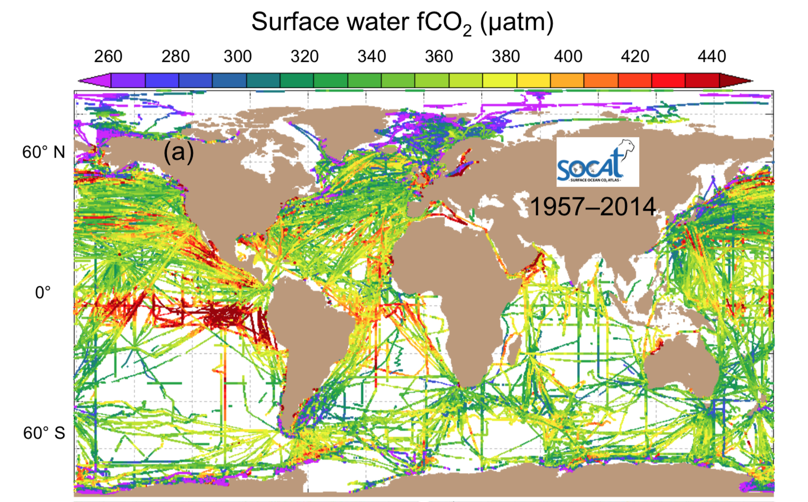
The Surface Ocean CO₂ Atlas (SOCAT) is a synthesis activity for quality-controlled, surface ocean fCO₂ (fugacity of carbon dioxide) observations by the international marine carbon research community (>100 contributors). It has over 20 million fCO₂ measurements .
TEMPORAL
period
historical
coverage
1957–2017
resolution
decadal, annual, monthly, instantaneous
SPATIAL
coverage
global
resolution
global 1° by 1°
coastal 0.25° by 0.25°
depth
surface
KEY REFERENCES
- Bakker, D et al. (2016). A multi-decade record of high quality fCO₂ data in version 3 of the Surface Ocean CO₂ Atlas (SOCAT). Earth System Science Data, 8, 383-413. https://doi.org/10.5194/essd-8-383-2016.