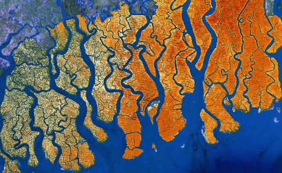
A global database of mangrove forest cover at high spatial and temporal resolutions that has been used to monitor mangrove cover at the global, national and protected area scales. Several databases including the Global Forest Change database, the Terrestrial Ecosystems of the World database, and the Mangrove Forests of the World database were used to extract the mangrove forest cover.
DESCRIPTORS
type
derived data
gridded
yes
formats
gis raster
TEMPORAL
period
historical
coverage
2000–2012
resolution
annual
SPATIAL
coverage
global
resolution
0.000277778° by 0.000277778°
depth
surface

MAJOR VARIABLES
KEY REFERENCES
- Hamilton, S. E., & Casey, D. (2016). Creation of a high spatio-temporal resolution global database of continuous mangrove forest cover for the 21st century (CGMFC-21). Global Ecology and Biogeography, 25(6), 729-738. https://doi.org/10.1111/geb.12449.

